Piste and Terrain Maps for HochZeiger
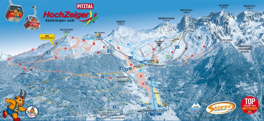
HochZeiger Piste Map
Piste Map for HochZeiger - Ski Resort in Pitztal, Austrian Alps - 54km of Piste
HochZeiger Location Map
Check the official Piste Map of HochZeiger or use the map below to locate accommodation and ski shops...
Tap symbols for info. Tap  for Full-Screen. +/- Zoom in to find Hotels and Hire Shops.
Switch view to map of Ehrwald, Kühtai-Sellraintal, Serfaus-Fiss-Ladis or Sölden.
